Changes needed in Land management to build a viable kerala
Land Management
Kerala has diverse land use and cropping pattern. The land reforms introduced in the State brought in radical and significant transformation in the land use pattern and conversion of agricultural land to other uses. To comprehensively capture your insights on all elements associated with land utilization, and their impact on the disaster resilience of the State, the theme of Land Management is being addressed through five relevant sub-themes – (i) Land Use, (ii) Agriculture, (iii) Settlements, (iv) Mining, and (v) Susceptible Zones.
Land Use
Kerala is the third most densely populated States in India, (behind Bihar and West Bengal- not considering the Union Territories and NCR) having a population density of 860 persons per sq. km. The State offers limited land for development and settlement due to its limiting geography of being an elongated strip of land wedged between the Western Ghats and the Sea with an area of 38,863 square kilometers, 580 km long coastline and only 35 -120 kilometer in width. As 48% of the State is categorized as highlands which hosts most of the forest area and ecologically sensitive zones, the settlements and habitations are concentrated to midlands and lowlands. Limited land availability in the midland and lowland has not only seen encroachment in forest areas in the highland but further encroachment of wetlands, river flood plains, and conversion of paddy lands in the midlands and lowlands.
This higher human intervention pressure on the available land entwined with the unplanned and unscientific proliferation and spread of human habitations have started aggravating the threats of natural calamities. Protection of environmentally fragile zones of the State covering the steeply sloping Highlands, Coastal region and the low lands have thus become an important task. Areas below sea level such as wetlands need a different approach towards land management and use as these are natural solutions against the flood protection. Continued changes in these land use have aggravated the problem of flooding and increased the vulnerability of the State and its people.
Key reasons for flooding and landslides can be attributed to the factors stated below:
- Reclamation and Conversion of wetlands, water bodies and paddy lands for dryland agriculture and (more often) for non-agricultural activities, reducing low lying spaces for retaining runoff water during rains.
- Reclamation, obstruction, and constriction of natural watercourses by the construction of roads, buildings, and other structures as well as due to unscientific construction of culverts, bridges, and bunds.
- Increasing and mostly un-planned urbanization (apart from converting or obstructing or constricting natural streams) resulting in an increase of built-up spaces that reduces infiltration of rainwater, whereby increasing the flash runoff during rains.
- Unscientific human interventions in environmentally fragile zones (both in the coastal area and in highlands) in the form of mining & quarrying, construction of heavy & tall buildings with fortress-like compound walls all around the plots, deforestation and un-advisable agricultural practices like rubber plantation on steep slopes.
There has to be a state-wide consensus-building process so that issues regarding the use of land can be resolved. Key questions to be answered related to land management are:
- What changes do you observe in land use patterns over the last decade, in your region?
- What type of open spaces are there in your habitat and how can it be conserved? Did monolithic compound walls around plots and buildings increased the flooding and affected rescue operations in your area. How can areas be developed to realize economic and fiscal benefits while taking into accountthe preservation of open spaces and protection of the environmental system?
- How has tourism affected the land use and what has been its effects on floods? How should we sustainably promote tourism?
- What land-use practices can be followed in your area to mitigate the risk of disasters? How community-based monitoring can be implemented to arrest future encroachments and ensure enforcement of the proper land use as per the plans?
- What are the other appropriate restrictions and the enforcement measures to ensure better land use? How can the available land be used more sustainably so that future generations have ample open spaces and equal access to these lands?
- Which are the changes in reclamation laws which have adversely impacted land use or settlements? What should be the steps taken to reverse the effects of the same?
Agriculture
Nearly 52% of Kerala’s population lives in rural areas, and 17.15% of the population depends on the agricultural sector for its livelihood. The sector has suffered severe losses and damages in the flooding and landslides of 2018 and 2019. Out of the three sub-sectors of crops, livestock, and fisheries, crops were the most affected, contributing to 88% of the total losses and damages to the sector. The effect of the floods has impacted the state’s economy and a large number of rural households which were dependent on agriculture.
The recovery vision for the sector is to develop sustainable, integrated, inclusive, eco-friendly, and resilient strategies in agriculture, fisheries, livestock, and allied activities. Short-term recovery will focus on the provision of inputs and restocking, replacement or repair of assets and infrastructure, and finding alternative income sources for the population. Medium- and long-term activities will focus on building resilience of each subsector through environmentally sustainable integrated farming systems, community-based management of water resources, promotion of traditional indigenous livestock breeds (resilient to local conditions), improvements in value chain, setting up of early warning systems, and effective communication with enhanced GIS/technology backed capabilities. Agriculture is not profitable in many parts of the State due to the fragmentation of agricultural land, and rising agricultural wages. Cropping in highlands and hilly terrains are facing several challenges like significant damages to agricultural land and plantation crops in Idukki and Wayanad due to natural calamities, increasing landslips and soil erosion presumably triggered by unscientific cropping systems like rubber cultivation on slopes, significant soil losses and crop losses due to poorly-planned intensive cropping. Massive flooding and inundation of fields, rotting of crops, and wilting of trees in Kuttanad and Kole regions are the key concerns for cropping systems in the midlands, lowlands, and wetlands whereas saltwater intrusion causes alarms in coastal areas. There is a need to identify alternative cropping systems to reduce silt deposition and soil erosion due to landslides. The irrigation systems of the State are mostly suited for paddy and not for commercial crops, and there is a heavy reliance on groundwater which is already constrained. There is a need to reorient the potential of existing irrigation systems to suit the other crops such as vegetables, fruits, flowers, etc by linking them to existing and new water sources through gravity or lift to utilize the surplus water from the irrigation projects on account of reduction in paddy cultivation. The growing density of population and spread of urbanization resulted in the conversion of farmland into residential and commercial establishments, roads and other utilities. Low uptake of crop-based and weather-based insurance schemes are also key concerns. The floods also resulted in the loss of livelihoods to a large section of farmers and agricultural laborers, especially women and vulnerable groups engages in agriculture and allied activities.
Under a project coordinated by Kerala State Planning Board in 2015, the agro-ecological delineation of Kerala was undertaken. Based on climate, geomorphology, land use and soil variability, Kerala has been delineated into 5 major agro-ecological zones, and 23 Agro-ecological Units (AEUs), which were then regrouped into 20 Agro-ecological Management Units (AEMUs) after consideration of administrative boundaries. There is a need to ensure participatory planning and decision-making on the implementation of AEZs, and ensure efficient land use planning, crop patterns, resource allocation and utilization, extension activities, etc in alignment to the AEZs and AEMUs.
Given the above context, the following questions may be discussed:
- What changes can be brought to the existing cropping patterns and systems in the context of enhancing the disaster resilience of farming and allied activities? To what extent are the existing systems of integrated farming , multiple-cropping , crop rotation , etc effective in ensuring disaster resilience?
- What are the ways, in which collective farming can be encouraged in fallow lands? What are the requirements – technical (water availability), institutional, financial, and others?
- In recent times, there has been an increasing trend of agricultural land being put to non-agricultural uses, mainly for commercial purposes. What are the possible guidelines and strategies to be established to restrict such activities which affect the disaster resilience of agriculture and allied activities? To what extent are the existing guidelines and regulations effective in restricting such activities? What steps can be taken to enhance the effectiveness of such guidelines and regulations?
- What are the strategies to be adopted for ensuring efficient local planning, mapping suitable crop varieties, resource allocation, tailoring schemes/interventions, etc to AEMUs and AEZs? What are the key considerations to be made while re-aligning the administrative boundaries at the District, Block and Village level institutions of the Department of Agriculture? What are the associated challenges, and possible solutions to address the challenges?
Settlements
Flood is the most common of natural hazards that affects the State. Nearly 14.5% of the State’s land area is prone to floods, and the proportion is as high as 50% for certain districts. Such exposure creates higher vulnerability for the settlements in risk-prone districts and areas.
The State of Kerala has a unique settlement pattern unlike any other State in India. Almost three-quarters of the population lives in urban areas, urban sprawls, and fast urbanizing rural areas. The habitation of the State is spread continuously without much open lands or fields separating habitations. In Kerala, several small and medium towns are distributed across the State’s geography, whereas rural area mainly consists of vast agricultural lands with hamlets distributed sporadically. Significantly, in the 2011 census, the population of the State was almost equally divided between rural and urban areas. The State has now an urban population of 159 million which accounts for 47.7 percent of the total population against a rural population of 174 million (52.3 percent). The decadal growth rate of the urban population is 92.72 percent in 2011.
The following questions may be addressed:
Context and Problem Identification
- What are the changes in the settlement pattern that you observe in your area over recent years? (Have the houses got bigger/smaller in size; more/less in number in your area; changed in the type of construction like kachha/pucca?)How has the spread of settlements affected the natural watercourses and water bodies in your area? and how that had contributed to the floods and droughts in the locality?
- Are there new settlements which get frequently affected by floods? What might be the reasons for these settlements to be regularly flooded?
- How are people and government responsible for some of the disaster effects the settlements are facing?
Solutions
- Are you familiar with the flood-resilient building techniques that are resilient or climate/flood proof in design? How, in your opinion, could the houses/buildings/settlement be made safe from flooding? (Measures to make these settlements less susceptible to floods and reduce the losses of lives and infrastructure; new building materials, techniques, technologies that can be used)
- What can be the other mitigation measures to compensate for the effects of future change in these settlements? (Alternate measures to cope up with the high population density and limited land availability in your area)
- Will the enforcement of proper building codes help in reducing losses in the susceptible areas? (Identify the susceptible areas)
Implementation and Enforcement
- What should be the approach for implementation of any rules/regulations/codes to avoid any lapses related to susceptible areas?
- What can be existing solutions prevalent in Kerala that can be incorporated into building rules or municipal/panchayat acts?
- How can the community monitor and avert future encroachments?
- What are the appropriate restrictions and the enforcement measures to abide by the land use in the new settlements or susceptible areas? (Approach for overall land use planning or designing settlement patterns across the state; what is currently lacking in the system and must be changed in land management practices?)
Mining
Mining is one of the critical subjects for debate in land use, as any unsustainable mining practices can result in irreversible losses to the environment, which in turn can have long term repercussions on the overall resilience of the state.
In Kerala, mining activities on large scale are confined mainly to a few minerals - Heavy Mineral Sands, China Clay and to a lesser extent Limestone/Lime shell, Silica Sand and Granite. In fact, Heavy mineral sand and China Clay contribute more than 90% of the total value of mineral production in the State1. However unscientific mining of river sand and granite quarrying are identified to cause major threats to the hydro-ecological wellbeing of the State.
The critical challenges in the state regarding mining are –
- Unregulated mining activities
- Granite quarries that use explosives in the vicinity to human and animal settlements and disaster-prone areas.
- Heavy sand mining in the rivers
- Relaxation in the minimum permissible distance limits
These factors have led to increased exposure to disasters and had subsequent impacts downhill. In the floods of 2018, quarrying accelerated landslides in vulnerable areas. It is critical to address the techniques employed in quarrying in the State to ensure environmental safeguard and risk reduction in the event of a disaster. Unregulated sand mining in rivers and watersheds has led to bank erosion, lowering of the water table and created other environmental problems such as water pollution. It is critical to address the techniques employed in quarrying in the State to ensure environmental safeguard and risk reduction in the event of a disaster.
The following questions may be considered for consultation with the community and other relevant stakeholders to understand the issues concerning mining activities and what solutions can be derived for enhancing resilience in the sector.
- What impact does mining have on the habitations and settlements in the region? Have you personally experienced any effect of mining resulting from the proximity of mining sites? (Health impacts, Lifestyle impacts)
- Does mining advance the incidence of floods and landslides? If yes, how can it be tackled?
- What measures can be taken by the local governments to safeguard the interests of the communities in light of unregulated and illegal mining?
- What changes can be made in the existing rules and regulations to safeguard the environment and to promote sustainable mining activities?
- How can the livelihoods of the people involved in illegal mining be diverted and revived?
- How can the community help in monitoring and averting illegal mining activities?
- What alternative purposes can be served by the abandoned quarries in your locality?
1Department of Mining and Geology, Gov. of Kerala.
Susceptible Zones
Kerala is susceptible to disasters like large scale erosion of the shorelines, landslides, floods, droughts, and earthquakes. Each of these disasters is concentrated in certain areas of the state, and thus can be clustered in zones. These disaster specific zones need a tailored approach based on their geographical and socio-economic situation towards planning and disaster risk reduction.
Coastal erosion: Kerala has a 593 km long coastline which is subjected to tidal and waves movements eroding the shorelines. The fisherman community in the area is worst affected by the persistent loss and damages for livelihoods and settlements, due to this regular phenomenon.
Shallow nearshore marine ecosystems are changing at an increasing rate due to a range of human activities such as the construction of new ports, which further increase commercial development and overall human footfall in a given area. These activities result in structural modifications in coastal spawning habitats of fish. They adversely impact many coastal fish populations and change the composition of fish communities. Therefore, construction and other development activities on the coastal land need special attention to conserve coastal habitat without losing the socio-economic benefits of development.
Loss of land in an already densely populated state poses further questions of sustaining settlements and livelihoods. It is imperative for effective land use planning to understand the ways the fisherman community and others are coping with this persistent threat.
An indicative line of inquiry is suggested for consultations on the issue.
- What are the key factors that have led to an increase in coastal erosion in the region?
- What impact does coastal erosion have on the livelihoods of the fishermen, paddy farmers, and coastal communities?
- What impact do previous preventive interventions like protection walls have had on coastal erosion? Has it resulted in the deepening of the near sea? What measures do you recommend for arresting coastal erosion?
- What is the impact of coastal structures such as ports, breakwaters, groynes, etc. in the region? Has it contributed to coastal erosion or accretion?
- What measures can be taken by the local government to mitigate the environmental and physical losses due to the coastal erosion?
- Are there ways of sustainably reducing coastal erosion, if yes, then what are the possible solutions?
- How are affected communities coping with their livelihoods? Are there any alternative livelihood options in the region that can be promoted for enhancing resilience?
- Is there a possibility of finding enough land (at safe distance from high tide line, but not too far) for the rehabilitation of the most vulnerable households along the shoreline?
- Which activities, if any, can the coastal community take up to build a protective mangrove forest belt along the coast to protect the shoreline?
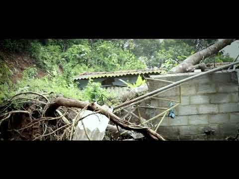
Landslides: Landslides in Kerala are becoming more frequent, and when coupled with events of flooding, they have caused havoc as experienced during the floods of 2018 and 2019. The scientific community ascribes phenomena like soil piping, deforestation, unregulated mining, and unscientific land use planning for the aggravated occurrences and consequences of landslides, triggered by the high-intensity rains.
Landslide hazard mitigation strategies generally involve hazard assessment mapping, warning systems, control structures, and regional landslide planning and policy development. Hazard mitigation could be sustainable only if natural resources management is closely connected to local economic and social interests. Hence, inputs and suggestions are requested from the community for reducing the number and consequences of landslides and the associated losses.
- What, in your view, are the key reasons for landslides in your region?
- Has the occurrence of landslides recently increased/decreased/stayed the same?
- What, if any, are the changes in the land use along the slopes over the years in your region?
- How do you think the following affected the landslide occurrences in your region –
- Vegetation pattern along the slopes
- Settlements
- Groundwater
- Cropping pattern
- Other activities, if any (name them)
- What efforts can be taken to reduce landslides and their impact in the following context?
- Physical efforts like control structures
- Structural changes in settlements
- Policy shifts or new policies
- Enforcement of existing regulations and bans on certain development activities, mining, etc.
- New Regulations
- How can the community effectively monitor activities on which restrictions are enforced?
- What coping measures should be adopted for restricted activities having bearing on livelihood of people?
- What could serve as the most effective early warning system in your village to communicate the possible landslides?
- What are the causes of drought in your region?
- What are the coping measures against droughts? Can these coping measures be scaled out for wider implementation?
- What are the alternate water sources available?
- What role can the community play in protecting and preserving a drinking water source and in mitigating droughts?
- What provisions are available with local panchayats to deal with droughts?
- What measures should be taken by the government to reduce the incidence of drought in the region?
- How can access to drinking water in times of scarcity be improved?
- What demand-side management strategies can be adopted by the community to reduce demands in times of drought?
Droughts:It is being reported from the ground that there have been unforeseen changes in the natural water systems post the flood. Within days after the floods, there is a drastic decrease in the river flows and most of the lower order streams are also drying up. Open wells which are a major source of drinking water is also showing sudden drawdown across the state. Therefore, it is believed that the state should prepare for events of droughts even in the wake of recurring floods and a normal monsoon next year.
Unlike floods, droughts are considered distinct due to its longer evolving time. It normally manifests as a result of the reduction/absence of precipitation for a longer period. It is therefore difficult to conceive of drought immediately after torrential rains and floods, unless the unique geographical, hydrological and meteorological features of Kerala are not taken into account. As mentioned earlier, geographically our State is an elongated strip of land wedged between the Western Ghats and the Sea with about 35 -120 kilometers only in width and with the general terrain sloping towards the western sea. Hydrologically the State interlaced with numerous streams of very short length that would drain away the runoff water to sea in a very short duration. Meteorologically, the State is constrained with most of the rains (the only natural source of fresh water) coming down in two monsoons occurring in a very short duration of the year, leaving out lengthy durations of the dry season in between. The combination of these features coupled with changes in land-use pattern reducing natural water bodies and increasing built-up spaces and unrestricted mechanized river sand mining resulting in depletion of water holding sand cushion in river beds has resulted in ever-increasing episodes of severe droughts in the State. The spread of habitations to the water-scarce areas had aggravated the situation. This demands that the Disaster Management plans of 2016 at the state and district levels will have to be improved to better deal with droughts.
The fundamental question that surface while discussing droughts in Kerala is that how the natural water bodies and other traditional sources of water could be reclaimed and what all new water conservation systems could be designed and introduced to mitigate the droughts? However, this demands absolute cooperation and involvement in society. Thus, to truly understand the issue, there is a need to ask the communities affected by droughts before enforcing solutions.